
The best hikes in San Diego, ranked: 10 trails from the coast to Cuyamaca
The best hikes in San Diego start an hour east of the beach, on a granite point in Cuyamaca Rancho State Park called Cush-pii. You probably know it as Stonewall Peak. It’s 2 miles up, there’s a stone staircase and a handrail for the last pitch, and in late October the black oaks below it go gold. That’s #1. Cowles Mountain is the hike everyone in the city has done, and it’s #2 for reasons we’ll get into.
This list ranks 10 trails across the coast, the inland foothills, and the mountains, and every entry says why it beats the one below it. We checked each trailhead against this month’s park and county notices. That matters right now, because the most famous hike in town, Torrey Pines, is closed until spring, and most of the lists online haven’t caught up.
How we ranked the best hikes in San Diego
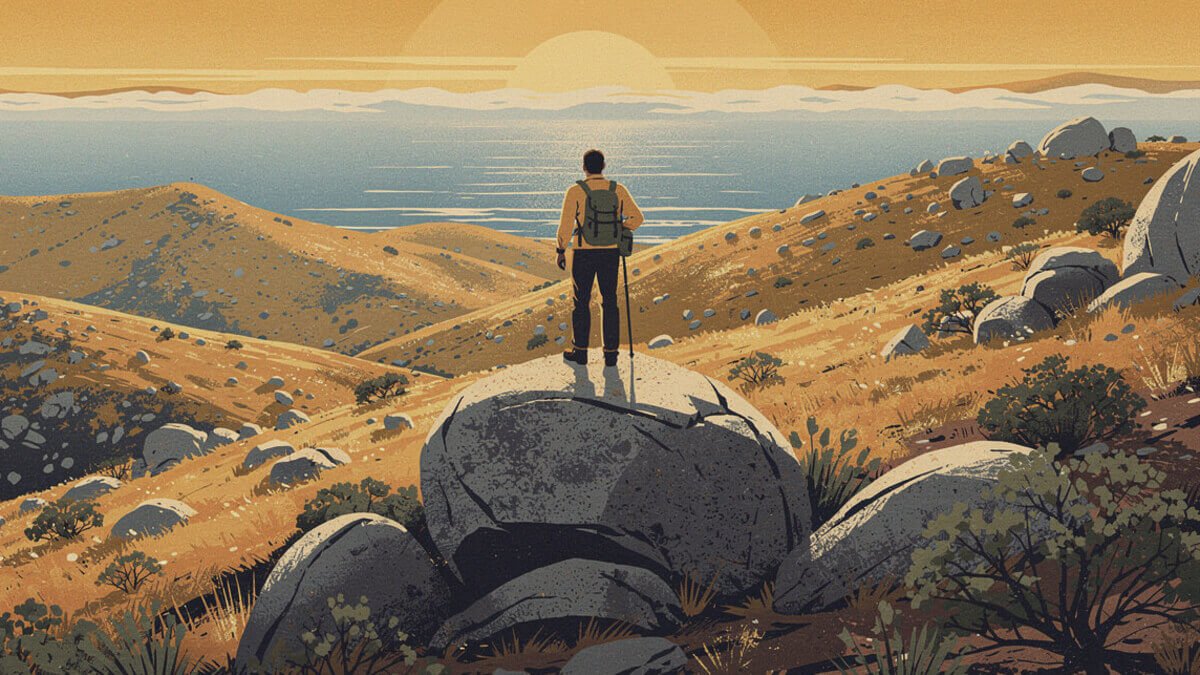
Four things decide the order:
- The payoff. A summit you can see from the freeway, a view into the desert, a canyon you squeeze through sideways. Something you’re still talking about at the taco shop afterward.
- Effort for the reward. A 4-mile hike with a 360-degree summit beats an 11-mile slog with the same view, unless the slog is the point.
- How it holds up on a normal day. San Diego’s best-known trails get crowded. A hike that’s great at 7 a.m. on a Wednesday and a conga line at 10 on a Saturday loses a little.
- Is it actually open. A ranking that sends you to a locked gate is useless. Anything closed right now is in its own section below, with the date it should come back.
Distances and climbs are for the standard route and are approximate. Park agencies, trail apps, and guidebooks disagree by a few tenths of a mile, so treat the numbers as close, not exact. Fees are the ones posted by the managing agency in October 2026.
One more thing about San Diego hiking in general: the county runs from the Pacific to the Anza-Borrego desert, and the weather changes more in a 60-mile drive than it does in a whole season on the coast. A cool, gray morning in Pacific Beach can be 95 degrees in Poway by noon. Most of the inland trails on this list have little or no shade. Start early, and carry more water than you think you need.
The best hikes in San Diego, #1 to #3

1. Cush-pii (Stonewall Peak), Cuyamaca Rancho State Park
About 4 miles round trip. Summit about 5,700 feet. Trailhead: Paso Picacho.
Cush-pii is the best hike in San Diego County because it gives you the most for the least. The trail climbs 2 miles from Paso Picacho on steady switchbacks through pines and oaks, and then the forest drops away and you’re on a bare granite point with stairs cut into it and a rail to hold. From the top you see Cuyamaca Peak right across the valley, Cuyamaca Lake below, and on a clear day a long way out toward the desert in one direction and the coast in the other.
The name is new on the map, and it’s worth knowing. The U.S. Board on Geographic Names approved Cush-pii, Kumeyaay for “sharp peak,” in December 2025. The old name came from the Stonewall Jackson Mine, a gold mine nearby that dates to 1870. The State Parks website still calls it Stonewall Peak, so you’ll see both names for a while.
Why it beats #2: Cowles has the better city view and you can do it before work. Cush-pii is a real mountain with a real forest, and in fall it has the best color in the county. If you can only give one Saturday morning to a hike, give it to this one.
The insider detail: go between late October and mid-November, when the California black oaks turn. Day use at Cuyamaca Rancho is $10 per vehicle, posted on the State Parks site. Make it a day: Julian is a short drive north for pie, and the Cuyamaca Peak trail (#7) leaves from the same lot.
2. Cowles Mountain, Mission Trails Regional Park
About 3 miles round trip, about 950 feet of climbing. Summit about 1,590 feet. Trailhead: Golfcrest Drive at Navajo Road, San Carlos.
Cowles (say it like “coals”) is the highest point in the city of San Diego, and the whole city knows it. From the top you get the full 360: downtown and Point Loma to the west, the Pacific beyond, Mexico to the south, the Cuyamacas to the east, and the rest of Mission Trails at your feet. The mountain is named for George A. Cowles, an El Cajon Valley rancher from the 1800s known as the Raisin King. The park around it covers more than 8,000 acres, one of the largest urban parks in the country.
Why it’s #2 and not #1: it’s a short, steep, exposed hill in the middle of a neighborhood, and on weekends it’s genuinely crowded. Some people love that. It’s part of the point: Cowles is where San Diego goes to sweat before brunch. But it’s a workout with a view, and Cush-pii is an outing.
Why it beats #3: Iron Mountain is a better trail in some ways, longer and quieter. Cowles is half the time and the view is bigger, because you’re looking at the city and the ocean, not just the backcountry.
The insider detail: the main lot on Golfcrest is small and fills early. The quieter way up starts from Barker Way on the north side (street parking only, restrooms at nearby Big Rock Park), and there’s a longer route from Big Rock Road. Go for sunrise, or for the last hour before sunset when the light comes in off the water.
3. Iron Mountain, Poway
About 6 miles round trip, about 1,100 feet of climbing. Summit 2,696 feet. Trailhead: the 67 at Poway Road.
Iron Mountain is the local favorite in North County, and for good reason. The grade is friendly, the footing is good, and the trail is wide enough that it never feels like a line. The summit looks down on the San Vicente Reservoir and out across the backcountry to the Cuyamacas.
Why it beats #4: Mount Woodson, across the highway, has the famous photo. Iron Mountain has the better hike. It’s shorter, gentler, and it holds up on a weekend in a way Potato Chip Rock doesn’t.
The insider detail: there’s almost no shade, so it’s a cool-season hike. The City of Poway closes its trails when the forecast hits 100 degrees or there’s a heat advisory, and that can still happen in October. If the main lot at Poway Road is full, the Ellie Lane staging area, a little north on the 67, has more room and a loop option.
#4 to #7: Potato Chip Rock, the bay, and the mountains

4. Mount Woodson and Potato Chip Rock, Poway and Ramona
About 7.5 miles round trip from Lake Poway with about 2,100 feet of climbing, or about 4 miles from the 67. Summit 2,894 feet.
Potato Chip Rock is a thin flake of granite sticking out off the side of Mount Woodson, and it’s probably the most photographed rock in San Diego County. It’s fun. You’ll wait your turn. The Lake Poway route is the real hike: a long climb through boulders and chaparral with the lake shrinking behind you.
Why it’s #4: the climb from Lake Poway is a great workout and the summit boulders are a playground. But the line at the chip is real on weekends, and the shorter route from the 67 follows a paved service road, which is a walk, not a hike. It beats #5 on effort and adventure. It loses to Iron Mountain on just about everything else.
What’s new this year: the County opened the Mt. Woodson Gateway County Preserve lot on the 67, just north of the Cal Fire station, in March 2026. It has about 200 spaces and a $5 day-use fee. New no-parking signs went up along the highway shoulder, so the old advice to park on the shoulder is out of date. At Lake Poway, non-residents pay $10 per vehicle on weekends and holidays.
5. Bayside Trail, Cabrillo National Monument
2.5 miles round trip, about 340 feet of climbing. Open 9 a.m. to 4 p.m.
This is the coastal hike while Torrey Pines is closed. The trail drops from the top of Point Loma down the bay side of the peninsula through coastal sage scrub, with San Diego Bay, the downtown skyline, Coronado, and the ships coming in and out of the harbor all laid out below. The Old Point Loma Lighthouse sits up top where you start.
Why it beats #6: it’s 15 minutes from downtown, it’s easy, and it’s the best view of the bay you can get without a boat. Garnet Peak has the bigger landscape, but it’s a long drive for a short hike.
The insider detail: the National Park Service charges $20 per car, good for seven days, so pair it with the tide pools on the ocean side of the point the same day. There’s no water or restroom on the trail and no dogs. From mid-December through March, the whale overlook near the old lighthouse is one of the best places on land to watch gray whales go by.
6. Garnet Peak, Laguna Mountains
About 2.5 miles round trip from the Garnet Peak trailhead on Sunrise Highway, or about 4 miles from Penny Pines on the Pacific Crest Trail. Summit about 5,900 feet.
Garnet Peak has the most dramatic view in the county for the least work. You walk through pines on the crest of the Lagunas, and then the mountain just ends. The east side drops thousands of feet into the Anza-Borrego desert, and on a clear day you can see the Salton Sea shining out in the basin.
Why it beats #7: Cuyamaca Peak is higher, but Garnet’s view is stranger and better, a whole desert opening up under your feet, and it costs you a third of the miles.
The insider detail: the Laguna Mountain Recreation Area is in Cleveland National Forest, so display an Adventure Pass ($5 a day) or an interagency pass. You can buy one at the Mount Laguna visitor center or the country store. Bring a jacket. At almost 6,000 feet it’s a lot cooler up here than at the coast, and windier.
7. Cuyamaca Peak, Cuyamaca Rancho State Park
About 7 miles round trip from Paso Picacho. Summit 6,512 feet.
Cuyamaca Peak is the second-highest point in San Diego County. The highest, Hot Springs Mountain at 6,533 feet, is on the Los Coyotes Reservation. From the top you see nearly the whole county, coast to desert, which is about as good a summary of San Diego as exists.
Why it’s #7: the view is enormous, but the route is a long, steady grind with less variety than its neighbor. It beats #8 on payoff. It loses to Cush-pii, across the valley, on everything but altitude. The good news is they share a trailhead and a parking fee, so strong hikers can do both in a day.
#8 to #10: a slot canyon, the big one, and a walk along the cliffs

8. Annie’s Canyon, San Elijo Lagoon, Solana Beach
A short loop: about half a mile from the North Rios Avenue trailhead, then a quarter-mile slot canyon.
Annie’s Canyon is the most fun you can have in under an hour on a trail in San Diego. You walk in from the end of North Rios Avenue and climb up through a slot in soft sandstone so narrow your shoulders touch both walls, with ladders in the steep bits. The canyon section is one-way up, and you come back down on switchbacks with a view of the lagoon and the ocean. The canyon used to be called the Mushroom Caves. It was restored and reopened in June 2016.
Why it’s #8: it’s short, so it’s more an outing than a hike, and it gets busy on weekends. It beats El Cajon Mountain for most people because almost anyone can do it, kids included.
The insider detail: street parking only at the end of North Rios Avenue, so don’t block driveways. Leashed dogs are fine on the lagoon trails but not in the slot canyon.
9. El Cajon Mountain, El Capitan County Preserve, Lakeside
About 11 miles round trip, roughly 3,500 feet or more of climbing. Summit 3,468 feet.
El Cajon Mountain is the hard one, and San Diego hikers who’ve done it will tell you about it unprompted. The trail climbs, drops, and climbs again, and the climbing on the way back out catches people off guard. From the top you see El Capitan Reservoir and most of East County.
Why it’s #9: it’s one of the best workouts in the county and the views are serious, but it’s a full day, it’s exposed, and it’s simply too much for most people. It ranks above #10 because it’s an actual mountain.
The insider detail: the County closes this preserve every August because of the heat. October through April is the season. Follow the County’s own rule of at least a liter of water for every two to three miles, which on this trail means a lot of water.
10. La Jolla Coast Walk Trail
About 0.6 miles each way, from the Coast Walk spur off Torrey Pines Road to the Cave Store above La Jolla Cove.
This one is a walk, not a hike, and it’s on the list because it’s the best cliff-top walk on the coast while Torrey Pines is closed. The path follows the sandstone bluffs above the caves, with the Pacific crashing in below, and it ends right above the Cove, where the sea lions are. You can hear them before you see them.
The rules there have changed in the last few years. Point La Jolla and Boomer Beach, right past the Cove, have been closed year-round since the City Council made the seasonal closure permanent in 2023. You can still enter the water there to swim, but otherwise stay on the walkway and give the sea lions their space. Down the street, the beach at Children’s Pool closes from December 15 to May 15 for harbor seal pupping. The breakwater walkway stays open, and it’s the best seal-watching spot in town.
If the sea lions are the part you keep thinking about on the drive home, the La Jolla Sea Lion Badge T-Shirt is ours: one sea lion and a badge that says how you actually pronounce it.
The insider detail: parking at the Coast Walk spur is a couple of cars at most, so park in the Village and walk the trail in reverse from the Cove. Go early. By late morning on a weekend, La Jolla parking is its own hike. Afterward, the best fish tacos in San Diego aren’t far.
The Buzz, weekly
Know what's buzzing before everyone else does
One email a week: what's blooming, what's opening, what's worth the drive, and new designs from the shop. No spam. Unsubscribe anytime.
Honorable mentions, and three to skip right now

Skip for now: Torrey Pines State Natural Reserve
Torrey Pines would be on this list most years. It isn’t this fall because the whole reserve has been closed since September 22, 2026 for construction, and State Parks expects it to reopen in March 2027. The closure covers every trail, the Beach Trail stairs, the Lodge, and the upper parking lots, to everyone, on foot or by car. Crews are replacing utility lines and an old restroom building, and adding accessible parking and paths. Torrey Pines State Beach and its north and south lots are still open, so you can walk the sand under the bluffs at low tide.
When it reopens, go see the trees. The Torrey pine is the rarest pine in the United States. It grows wild in only two places: here and on Santa Rosa Island in Channel Islands National Park.
Skip for now: Borrego Palm Canyon
Borrego Palm Canyon in Anza-Borrego Desert State Park, California’s largest state park, is a 3-mile round trip to a palm oasis, with a chance of seeing Peninsular bighorn sheep. Two things to know. It’s a cool-season hike, and October can still be brutally hot in Borrego Springs. Also, the first palm grove has been closed since a fire burned part of it in January 2020. The trail now ends at a viewpoint over the grove. It’s still worth it in winter. It just isn’t the walk-into-the-palms hike the old photos promise.
Save for after rain: Three Sisters Falls
Three Sisters Falls, off Boulder Creek Road near Descanso, is the best waterfall hike in the county when the falls are running. That depends entirely on rain, so in October it’s usually a long walk to dry rock. It’s an upside-down hike: easy going in, and the steep, hot climb is on the way out. The Forest Service closes it during extreme heat. Save it for a weekend after a good winter storm.
Honorable mentions
- Kwaay Paay Peak, Mission Trails. About 2.5 miles round trip to 1,194 feet. Steeper than Cowles, with a fraction of the crowd.
- Volcan Mountain, Julian. About 5.4 miles round trip to 5,353 feet. The stone gateway at the trailhead is by Julian artist James Hubbell.
- Cedar Creek Falls, Ramona. About 6 miles round trip down into the San Diego River gorge to a big swimming hole. You need a permit from Recreation.gov: $6, up to five people, 75 a day. Jumping off the cliffs is banned, and so is alcohol. Next year’s permits go on sale December 1.
- Los Peñasquitos Canyon waterfall. A mostly flat creek walk to a little boulder waterfall, right in the middle of the city’s northern suburbs. Easy with kids.
- Black Mountain and Double Peak. Two North County summits around 1,550 and 1,650 feet with big views for short drives.

For the end of the coast walk
The La Jolla Sea Lion Badge: one sea lion, one monoline badge, and a pronunciation note for your cousin from out of town. Psst, it’s La Hoy-a.
The best San Diego hike for what you want

Different day, different hike. Here’s the short version:
- Before work: Cowles Mountain (#2). In and out in under two hours, sunrise included.
- Fall color: Cush-pii (#1), late October into November. Then Volcan Mountain.
- Biggest view for the least effort: Garnet Peak (#6). The desert just opens up.
- Ocean: Bayside Trail (#5) for the bay, the La Jolla Coast Walk (#10) for the cliffs and sea lions. Torrey Pines when it reopens in March.
- With kids: Annie’s Canyon (#8), Los Peñasquitos, and the Bayside Trail.
- With a dog: check the rules before you go. The Bayside Trail and Torrey Pines don’t allow dogs, and Annie’s Canyon allows leashed dogs on the lagoon trails but not in the slot.
- The photo: Potato Chip Rock (#4). Go on a weekday.
- A real test: El Cajon Mountain (#9), or Cush-pii and Cuyamaca Peak back to back.
- Water: Cedar Creek Falls, with a permit, or Three Sisters after rain.
If you’re up north this season too, our ranking of the best hikes in the Bay Area does the same thing for Marin, the East Bay, and the Peninsula.
When to hike San Diego: a season-by-season cheat sheet

San Diego hiking season is roughly backward from the rest of the country. The good months are the cool ones.
- October and November: the start of the season. The inland trails are finally reasonable in the morning, and the mountains have color. Watch for heat waves and Santa Ana winds, which can push inland temperatures back up for a few days at a time.
- December through February: prime time. Clear, cool days are the norm, the coastal views are at their sharpest after a storm, and gray whales pass Point Loma from mid-December through March. The mountains can get snow, so check road conditions for Sunrise Highway and the 79.
- March through May: the hills are green, the wildflowers are out, and the desert is at its best in the early part of this window. Torrey Pines is scheduled to reopen in March 2027.
- June through September: stick to the coast and go early. “May Gray” and “June Gloom” keep the beaches cool in the morning, but the inland trails get dangerously hot. El Cajon Mountain closes every August, and Poway closes its trails on 100-degree days.
The County’s own hiking advice is short and worth taking seriously: carry at least a liter of water for every two to three miles, tell someone where you’re going, don’t count on your phone for directions or a signal, and hike with someone if you can.
For the post-hike stop: Iron Mountain, Woodson, and Cowles all put you within a short drive of the shops on our list of the best coffee in San Diego and the best tacos in San Diego.
Best hikes in San Diego: FAQ

What is the best hike in San Diego?
Cush-pii (Stonewall Peak) in Cuyamaca Rancho State Park: about 4 miles round trip to a granite summit with a staircase and a handrail, and the best fall color in the county. If you want something inside the city, Cowles Mountain in Mission Trails is the classic.
Is Torrey Pines open?
Not right now. Torrey Pines State Natural Reserve closed on September 22, 2026 for construction and is scheduled to reopen in March 2027. Torrey Pines State Beach is open.
What is the highest point in San Diego?
Cowles Mountain, at about 1,590 feet, is the highest point in the city of San Diego. The highest point in San Diego County is Hot Springs Mountain, at 6,533 feet, on the Los Coyotes Reservation. Cuyamaca Peak, at 6,512 feet, is second.
What are the best easy hikes in San Diego?
The Bayside Trail at Cabrillo National Monument (2.5 miles round trip), Annie’s Canyon in Solana Beach, the La Jolla Coast Walk, and the Los Peñasquitos Canyon waterfall. Garnet Peak is short, but it’s at almost 6,000 feet and it has some climbing.
How hard is the hike to Potato Chip Rock?
From Lake Poway it’s about 7.5 miles round trip with about 2,100 feet of climbing, which is a real workout. The shorter route from the 67 is about 4 miles round trip on a paved service road. Park in the new County lot ($5) rather than on the shoulder.
Do I need a permit or pass to hike in San Diego?
Most trails don’t. The exceptions on this list: Cedar Creek Falls needs a Recreation.gov permit, the Laguna Mountains need an Adventure Pass or interagency pass, Cuyamaca Rancho and Anza-Borrego charge a state park day-use fee, and Cabrillo National Monument charges a National Park Service entrance fee.
When is the best time to hike in San Diego?
October through May. Winter is the sweet spot for the inland and desert trails. In summer, hike the coast, and go early.
If you only do one
Drive the 79 up to Paso Picacho on a weekday morning in late October or November, pay the $10, and walk the 2 miles up Cush-pii. Hold the rail on the last steps, sit on the granite, and look across at Cuyamaca Peak with the oaks going gold below you. Then get pie in Julian on the way home.
If you can’t make the drive, go up Cowles Mountain at sunrise and watch the light come up on the whole city at once. That’s not a consolation prize. It’s the hike that made half of San Diego a hiker.
And if we missed your trail, we want to hear about it. There are a lot of good ones out there.
Before you go
Get the next ranking in your inbox
We write one of these every day. The best of them, plus whatever California is texting about this week, lands in one short email.